
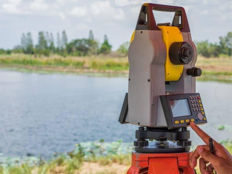
Rural land wasn’t set up for modern utilities. Most of it was built around farming, livestock, and family use. Nobody was thinking about broadband lines or sewer systems when those properties took shape. Now those utilities are pushing further out into rural areas, and the land in their path wasn’t designed for any of it. That’s why land surveying matters so much before any new work starts. It shows everyone what’s already on the ground before the digging begins.
When New Utility Corridors Reach Properties That Were Never Designed Around Them
A rural property that’s been in a family for decades was laid out for a completely different reason. The driveway goes where farm equipment needs it. The barn sits where the ground was flat. The fence lines follow the edge of a pasture. None of that was planned around future utility lines, because those things weren’t part of the picture back then.
When a utility company starts extending service into that area, they’re working through land that wasn’t set up for them. The route they draw on paper may look simple, but the actual ground tells a different story. Land surveying records what’s physically on the property, where the boundaries actually sit, and what’s already in the way before anyone stakes out a new route. That keeps the project from running into surprises once work starts.
Why Existing Fences and Improvements Do Not Always Match Planned Utility Routes
Barns, ponds, driveways, and old fence lines don’t move for a utility project. They’ve been sitting in the same spots for years, and they can cause real problems when a planned utility route runs right through them.
A fence line sitting a few feet off the recorded boundary might not matter on a quiet rural property. But it matters a lot when a utility easement gets staked along that same line. A pond near a planned route can change how the line has to be run. Land surveying finds these things before the utility company locks in a route. That way, problems get worked out on paper first, not in the field after equipment is already on site.
How Land Surveying Supports Coordination Between Property Owners and Utility Providers
Utility projects involve a lot of different people. The property owner knows their land one way. The utility company has a planned route based on their needs. The engineers have drawings that may not match what’s actually on the ground. When everyone shows up with different information, things slow down fast.
Land surveying gives everyone the same starting point. It shows the actual boundary, where existing features sit, and how the planned route fits with what’s already there. The property owner can see exactly where the work happens near their fence or barn. The utility engineers can check that their route works with real conditions. That shared picture keeps things moving instead of turning into a back-and-forth between parties working from different information.
What Happens When Expanding Infrastructure Crosses Properties With Different Ownership Histories
Rural utility projects don’t run through just one property. They cross multiple tracts, and those tracts often have very different histories. One parcel might have changed hands three times in ten years. The one next to it might have stayed in the same family since the 1950s. Old boundary descriptions and informal neighbor agreements that worked fine for years can cause confusion when a utility line needs to cross through all of them.
Here’s where accurate survey work helps when a project crosses rural tracts with complicated histories:
- Boundary issues between neighboring properties get spotted before the route is finalized
- Easement locations get tied to real recorded boundaries, not assumed ones
- Landowners with old or unclear records get updated information they can actually use
- Engineers and contractors work from the same property data across all tracts, not a mix of different sources
Sorting that out before work starts prevents disputes from showing up in the middle of a project.
Why Land Surveying Helps Rural Properties Adapt to Future Growth Instead of Just Current Needs
Utility expansion usually signals bigger changes coming. When broadband reaches a rural area, other things tend to follow. Roads get improved. More utility services extend further out. New housing and commercial projects start showing up on land that sat quiet for years.
A survey done today for a utility project stays useful when those next changes arrive. It records the boundary, documents what’s on the property, and sets reference points that carry forward into future work. Property owners who already have that information ready are in a better spot when developers or additional utility providers come back later. They know where their boundaries sit, what easements exist, and how their land connects to neighboring properties. That’s not just helpful for today’s project. It puts the property in a better position for whatever comes next as the area around it starts to grow.
Frequently Asked Questions
Why is land surveying important when utilities expand into rural areas?
It gives everyone accurate information about what’s on the property before new utility work gets planned or installed.
Which types of utility projects commonly involve land surveying?
Broadband, electrical, water, sewer, and natural gas projects all use survey information when extending service into rural areas.
Can existing improvements affect utility expansion?
Yes. Fences, driveways, ponds, and other long-standing features can affect where a utility route goes and how the work gets done.
Who uses land surveying during utility projects?
Property owners, utility companies, engineers, contractors, and developers all rely on survey information to keep projects on track.
Does land surveying help with future development planning?
Yes. Having accurate property information helps landowners understand how today’s utility work may affect what comes next as their area grows.